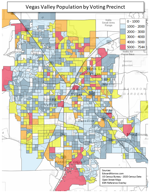
Vegas Valley - Population by Precinct
The map represents population by voting precinct for Nevada’s Las Vegas valley.

Sources: 2020 Census (P.L. 94-171) Redistricting Data Summary Files 2020 Census (P.L. 94-171) Geographic Products
QGIS was the Geographic Information System (GIS) software used for this project. Microsoft Access and Microsoft Excel were used to prepare the data.